The hiking paths in Aspen are fantastic! I’ve trekked the 10 best hikes in Aspen that all nature lovers will enjoy with breathtaking scenery!
Aspen, Colorado is a year-round vacation spot for outdoor sports enthusiasts because of its remote location in the Sawatch Range and the Elk Mountains of the Colorado Rocky Mountains.
Aspen provides top-notch hiking on everything from paved routes to rocky mountain summits, despite being associated with winter holidays and housing one of the region’s most immaculate ski resorts.
When your day of hiking the trails is over, Aspen, CO offers a variety of tasty dining alternatives that will satisfy your appetite.
Introduction to Aspen, Colorado
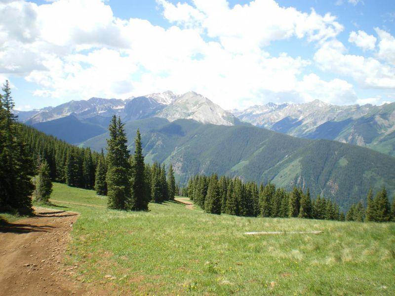
With more than 50 new trails developed in recent years, the Aspen Snowmass region transitions from a crisscrossing network of amazing ski runs to challenging hiking routes in the summer.
Keep an eye out and pay attention to the trail markings, as some of these paths are also accessible to mountain bikers.
If you want a treat after your climb, pick a trail that ascends to the Elk Camp Restaurant. From there, you could refuel before continuing up to the summit of Elk Camp for breathtaking scenic views of Bush Creek Valley.
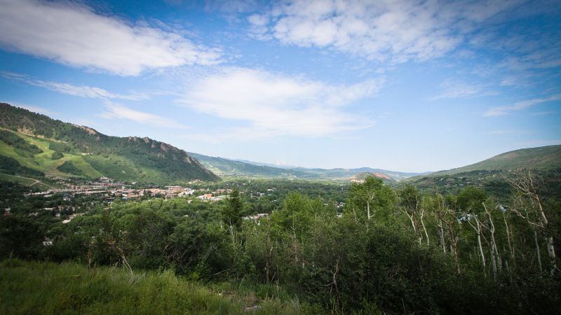
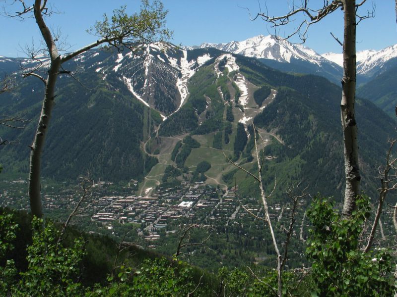
Aspen Mountain is a distinct hiking destination that offers town vistas and a major wilderness experience. You may reach the summit through a number of pathways, ranging from easy and meandering to extremely challenging.
What makes hiking on Aspen Mountain the best? You may always take the Silver Queen gondola back down at no cost if you overdid yourself on the hike up.
Tips For Hiking in Aspen Colorado
- Aspen, which is situated along the Roaring Fork River, is located at an elevation of just under 8,000 feet, and many of these climbs will take you above 10,000 feet, where the air is thinner. Know your limitations and be prepared for high-altitude hiking!
- Keep an eye on the weather as it changes. Colorado’s high-elevation regions get afternoon storms frequently in the summer. When lightning strikes, take cover and head to lower ground.
- Don’t forget your sunscreen because Aspen, CO, can get very sunny.
- Be careful and pay attention to route signage, as there are certain paths where walkers and bikers use the same path.
- The majority of routes and gondolas allow dogs, but you must keep them on a leash and keep in mind that there may be other wildlife, such as moose and bears, nearby.
Best Hikes Near Aspen for Beginners
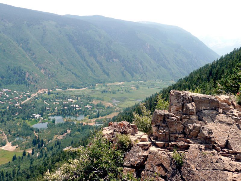
1. Smuggler Mountain
Difficulty: Easy
Distance: 3 miles
Time: 1-2 hours
Trail Type: In and Out
Where to Start: Park Circle 39.19157, -106.80802
The Smuggler Mountain hike is a wonderful first hiking experience in Aspen. Unlike a traditional mountain hike, this journey is made up of a winding dirt road that climbs Smuggler Mountain.
You will enjoy expansive views of town, the four Aspen Snowmass ski areas, and Sopris Mountain, which is regarded as Aspen’s crowning achievement. You’re in for an instagrammable photo op if you time your hike right and arrive at the viewing platform just before sunset.
The vertical climb on the Smuggler Mountain trail is around 800 feet. The three-mile round route can be extended to twelve miles with an additional thousand feet of elevation gain to reach Warren Lakes.
A short distance past the viewing platform is the Robbie Wade picnic area, which makes a great spot for lunch or an afternoon snack.
In Aspen’s northeastern corner, on Mill Street or Cooper Avenue, you will find the trailhead for Smuggler Mountain.
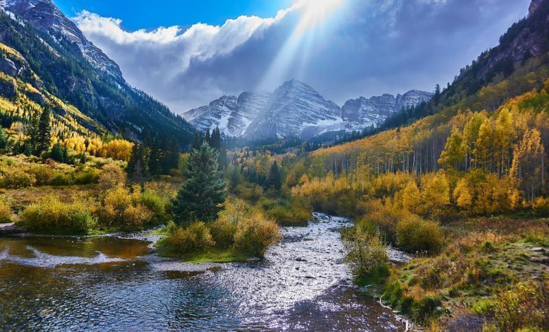
2. Maroon Bells
Difficulty: Easy
Distance: 1.5 miles
Time: About an Hour
Trail Type: Loop
Where to Start: Maroon Bells Trailhead 39.09880, -106.94171
In addition to Aspen Snowmass, the Maroon Bells climb features some of Colorado’s most breathtaking views. Visualize snow-covered mountains and golden aspens reflecting in the still lake and you get a scene straight from the movies.
There are several other hikes you can do from the Maroon Bells trailhead, but you shouldn’t skip the one that circles Maroon Lake. Take a leisurely stroll and enjoy the landscape on the northeast side.
If you are lucky enough to visit during autumn, Maroon Bells is one of the best fall foliage hikes in Colorado. Don’t believe me, just look at this pic…
If you intend to stay for the day, pack a picnic. You are welcome to cast a line out for some fish as long as you first obtain a Colorado fishing license.
The lake is located at a height of 9,580 feet, and there is little vertical gain, making this a fantastic outing for hikers of all experience levels.
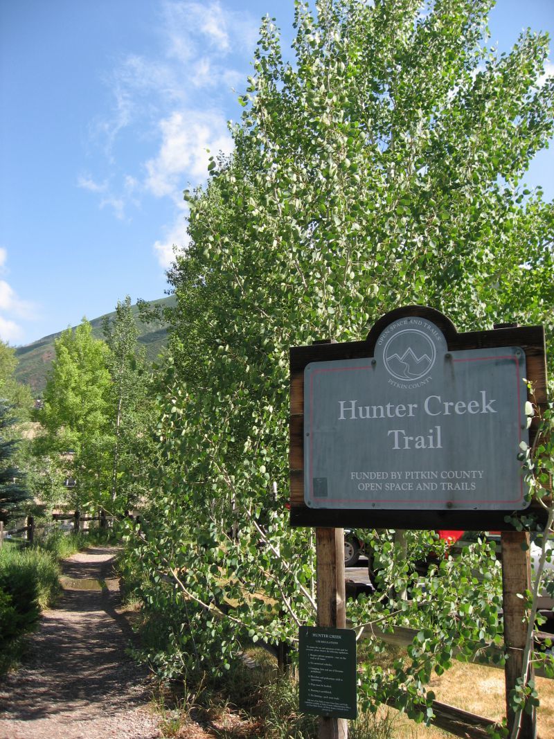
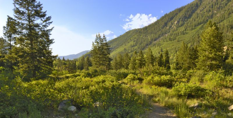
3. Hunter Creek
Difficulty: Easy – Moderate
Distance: 5 or 14 miles
Time: Anywhere from 1 hour to 6 hours
Trail Type: In and Out
Where to Start: Hunter Creek Road off Red Mountain Road 39.20195, -106.81258
With a trek along Hunter Creek, you will get a fascinating look at Aspen’s past. The Hunter Creek trail’s northern section is decorated with old mining huts, and the location offers scenic vistas of the Elk Mountains.
Are you up for a challenge? Try to locate the cabin hiding near the 10th Mountain Division Bridge or enter one of the cabins for a taste of mining history.
The Hunter Creek Trail’s biggest feature is that you can select between two distinct hikes or travel as far as you wish.
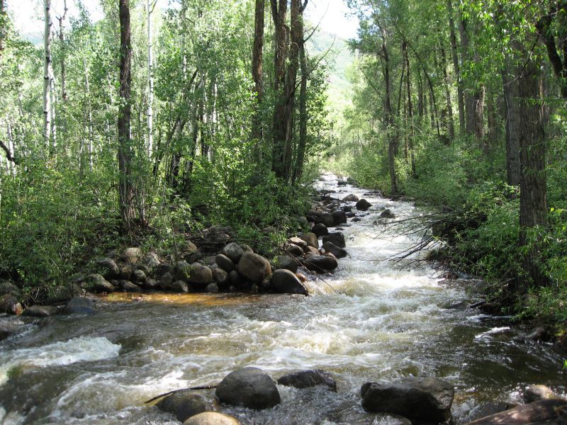
While it is seven miles from the 10th Mountain Bridge to the Midway Creek Trail, it is just 2.5 miles from the 10th Mountain Bridge to the Van Horn Trail.
Additionally, the Hunter Creek Trail links other well-liked backpacking trails.
4. Weller Lake
Difficulty: Easy
Distance: 1.2 miles
Time: Less than an hour
Trail Type: In and Out
Where to Start: Weller Lake Trailhead 39.12052, -106.72215
If you want a tranquil stroll east of Aspen, Colorado, the Weller Lake Trail is a fantastic choice.
You can explore several locations or spend the evening in downtown Aspen thanks to the accessibility of all the hiking paths off Highway 82 on Independence Pass.
With a simple 200-foot elevation climb, you’ll raise your heart rate just enough while taking in the clean scents of aspen and spruce forests.
Weller Lake is below the treeline, which makes for some sought-after woodland views, unlike many of Colorado’s alpine lakes.
Best Aspen Hiking Trails for Experienced Hikers
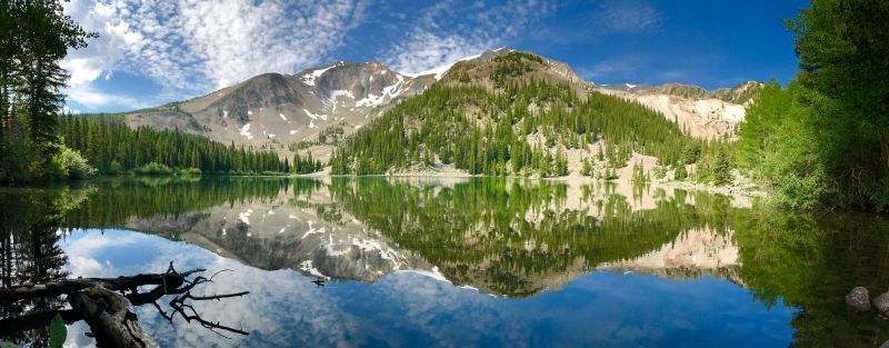
5. American Lake
Difficulty: Moderate – Difficult
Distance: 6.4 miles
Time: Approximately 3-4 hours
Trail Type: In and Out
Where to Start: American Lake Trailhead 39.07275, -106.80361
The American Lake Trail is the ideal route to prepare for longer hikes in Aspen, Colorado. You’ll get a fantastic workout in addition to an outstanding dose of nature!
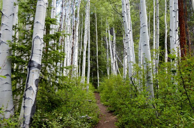
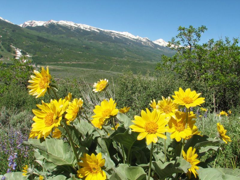
Before the trail swings south, it winds through aspen trees on steep slopes. Enjoy the change from spruce-fir forests to meadows dotted with wildflowers.
You will return through the forest, traverse a field of rock, and then turn left after hearing the sounds of a waterfall that will suddenly emerge.
The gorgeous basin of American Lake, framed by a granite ridge, is just a short distance away.
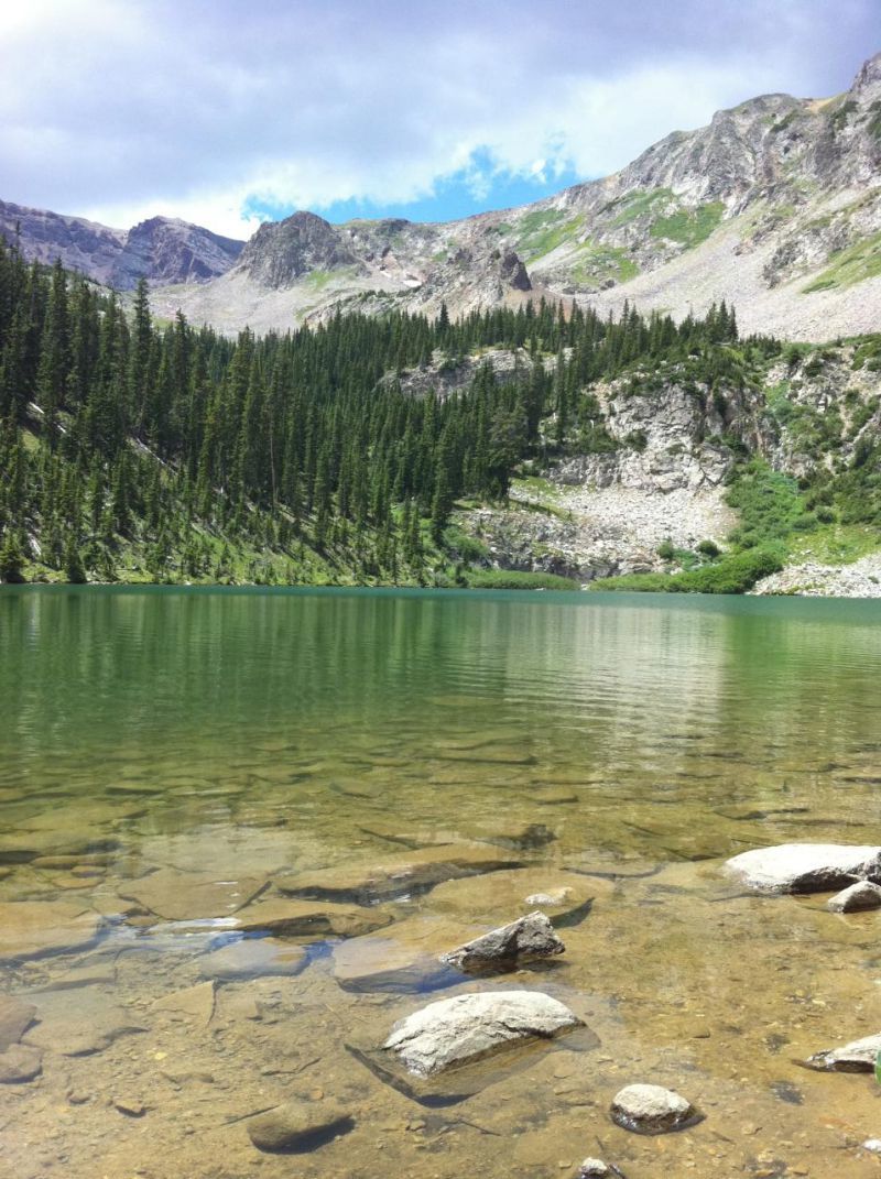
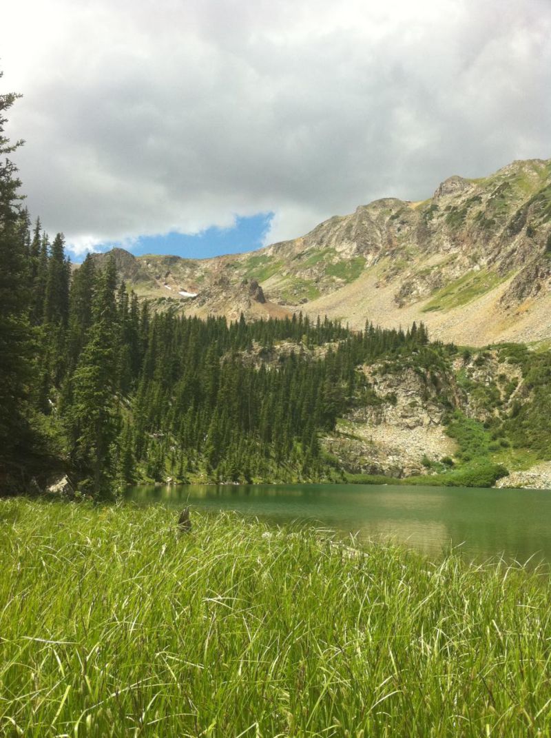
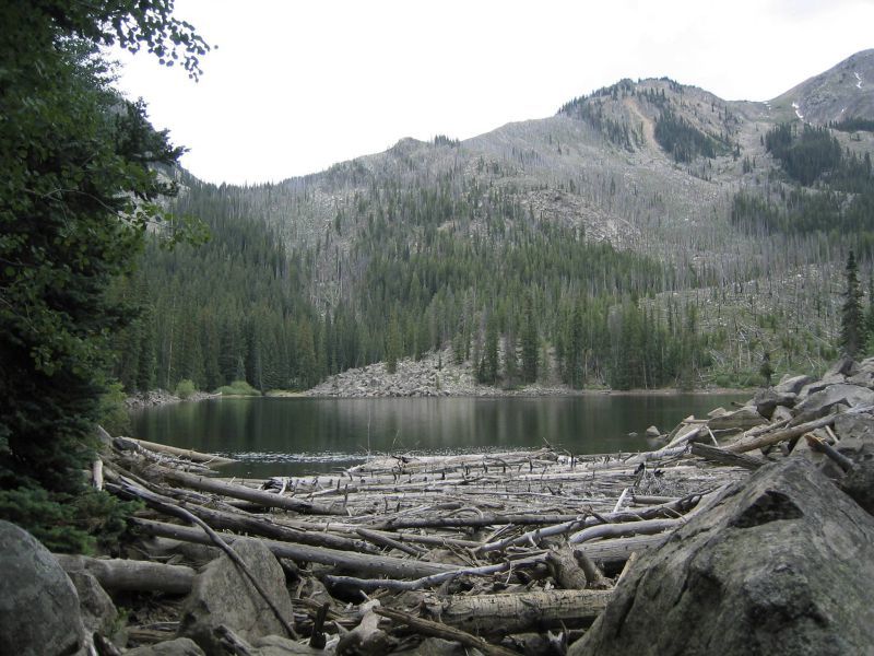
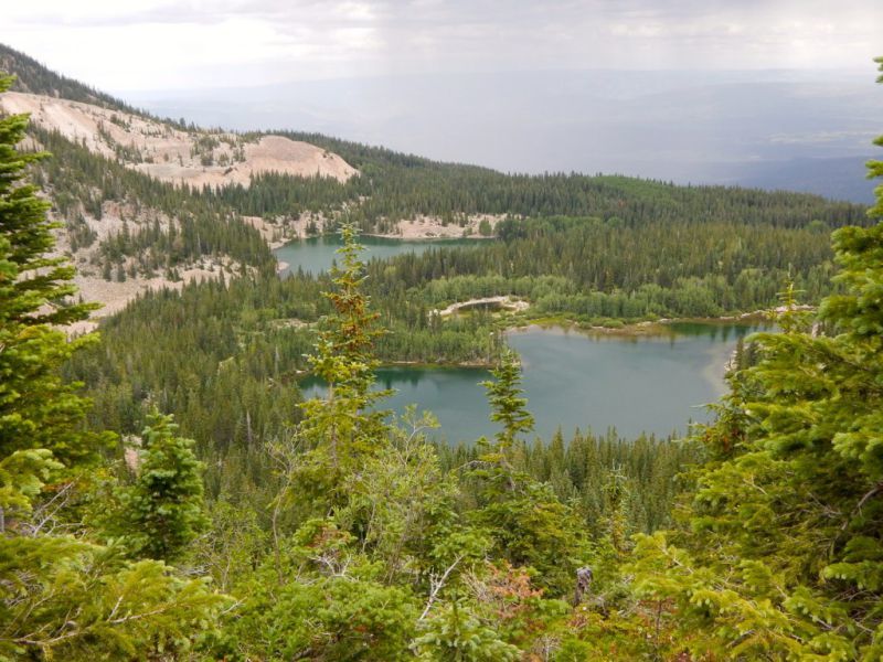
6. Grizzly Lake
Difficulty: Moderate
Distance: 7.1 miles
Time: Approximately 3-4 hours
Trail Type: In and Out
Where to Start: Grizzly Lake Trailhead 39.07773, -106.61070
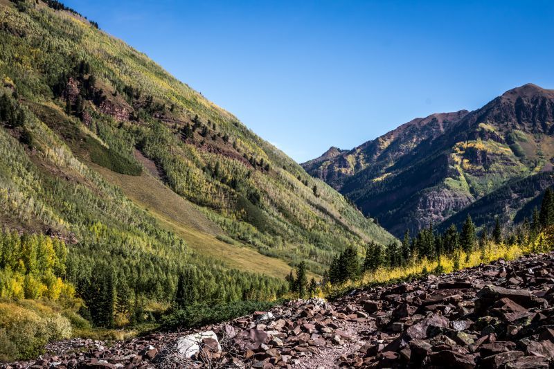
One of the moderate Aspen hiking paths is Grizzly Lake. You’ll pass through forests, meadows, and rocky cliffs as you rise to an alpine lake with breath-taking panoramas.
Be aware that early in the season, the last mile is frequently still covered in snow.
The Collegiate Peaks Wilderness is home to the Grizzly Lake Trail, which boasts an altitude increase of around 2,000 feet. Eight miles up Highway 82, turn right onto Lincoln Creek Road to reach the trailhead, which will be on your left after 6.3 miles.
The Grizzly Lake hike meanders through fields of wildflowers as well as pine and fir forests.
7. Ute Trail to Aspen Mountain
Difficulty: Difficult
Distance: 3.1 miles to the top, 6.2 miles round trip
Time: Approximately 3-4 hours to the top
Trail Type: In and Out
Where to Start: Ute Avenue 39.18236, -106.80897
The Ute Trail is the best option if you want to reach the top of Aspen Mountain. It is on the southeast side of Aspen and adds a lot of elevation in a short amount of time, including 700 feet in the first mile. Prepare to have your fitness and mountain endurance tested!
The Ute Trail sees a lot of use from devoted local hikers, many of whom use it as their daily exercise.
Take in views of the Independence Pass, the majestic Collegiate Peaks, and the Aspen Highlands.
A cool feature…The majority of the Ute Trail is in the shade, making it a fantastic summer outing. The turn-around spot for those who could have gotten in over their heads is a rocky overlook about a mile up.
If you start to feel exhausted at the summit, you can take a gondola back down.
8. Cathedral Lake
Difficulty: Difficult
Distance: 5.6 miles
Time: Approximately 3-4 hours
Trail Type: In and Out
Where to Start: Travel 0.5 miles outside of Aspen to the roundabout on Highway 82 where you’ll turn right on Castle Creek Road. Go 12.2 miles and then turn right onto a gravel road and another 0.5 miles will take you to the trailhead.
39.04299, -106.80746
One of the best hikes close to Aspen is to Cathedral Lake if you’re trying to see as many alpine lakes as possible. You’ll have to work for your views because the Cathedral Lake trek is strenuous.
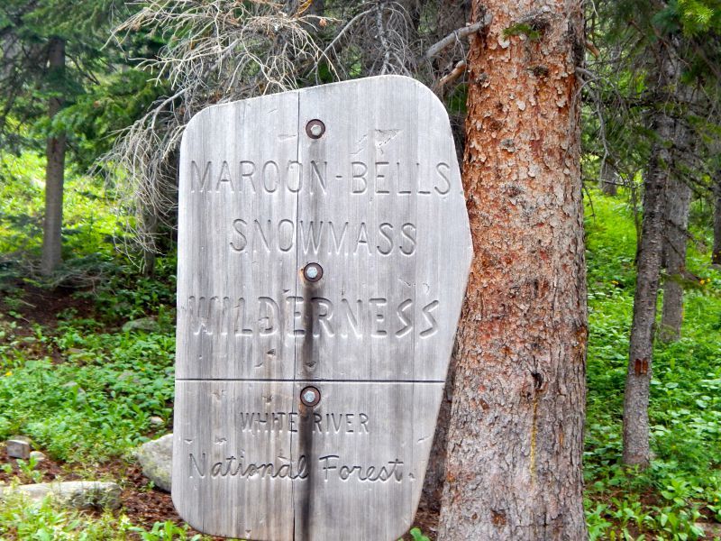
Before approaching the Maroon-Snowmass Wilderness, revel in a tour through an amazing aspen grove. The path steepens as it meanders beside Pine Creek at this point.
The second portion of the route, which involves climbing through scree fields and up steep switchbacks, demands greater physical fitness.
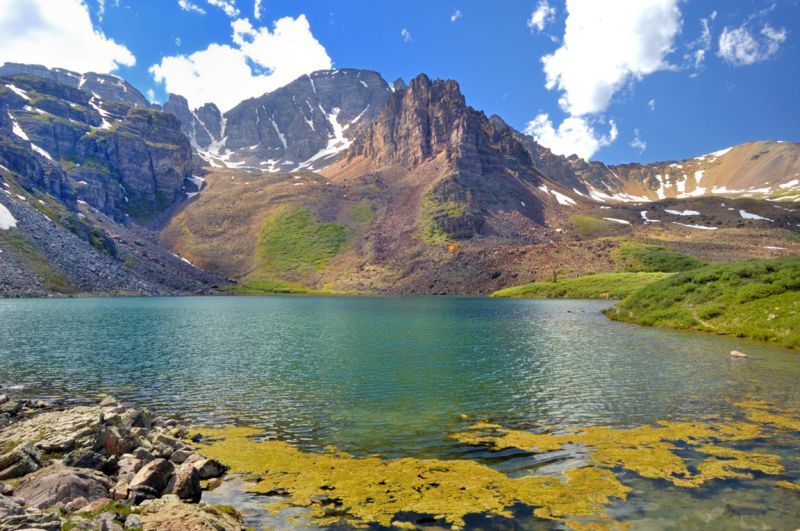
Where the trail splits, bear left to experience a world beyond your wildest imagination. Standing at a height of about 14,000 feet, you can take in views of Cathedral Lake and Cathedral Peak rising next to it.
Check Out: Best Hikes Near Boulder Colorado
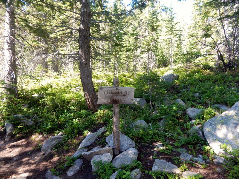
9. Mount Sopris
Difficulty: Very Difficult
Distance: 12 miles
Time: Approximately 7-9 Hours
Trail Type: In and Out
Where to Start: Dinkle Lake 39.30430, -107.12395
The peak that can be seen from Smuggler Mountain is Mt. Sopris, which is regarded as the most prized gem of the Aspen climbs. Start early because the journey to the summit takes the entire day.
It’s important to adapt to the elevation because Mt. Sopris rises to a height of 13,000 feet!
The Mount Sopris trail is for you if you like hiking through multiple landscapes.
Thomas Lake is reached after miles of wide meadows on the ascent. From here, you can scale the summit’s ridgeline and take in the alpine scenery above the woods. Expect plenty of rocky, steep sections, as well as some scrambling over boulders.
Continue on to the memorial at the very end rather than being deceived by the false summit.
Enjoy views of the famous 14ers Maroon Bells, Pyramid Peak, Capitol, and Snowmass, as well as McClure Pass to the south.
Don’t Miss: 10 Best Hikes in Telluride
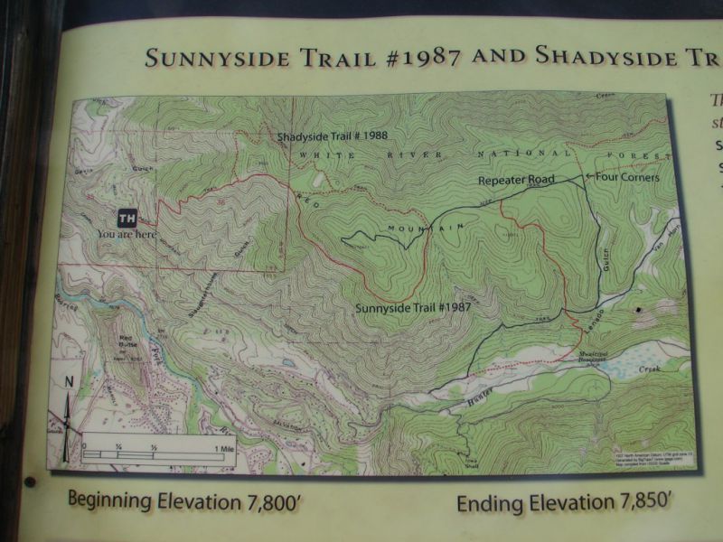
10. Sunnyside
Difficulty: Difficult/Extremely Difficult
Distance: 4 miles or 20 miles
Time: Approximately 2-3 hours or one day
Trail Type: In and Out
Where to Start: Stein Park/Cemetery Lane 39.21181, -106.84014
Sunnyside Trail, which lives up to its name, enjoys lots of sunshine and provides expansive views of Aspen, Colorado. There are two alternatives available, one starting at the Rio Grande Trail off of Cemetery Lane and the other, which is somewhat longer, starting from Hunter Creek Valley.
This trail is ideal for winter hiking because it is warm and dry.
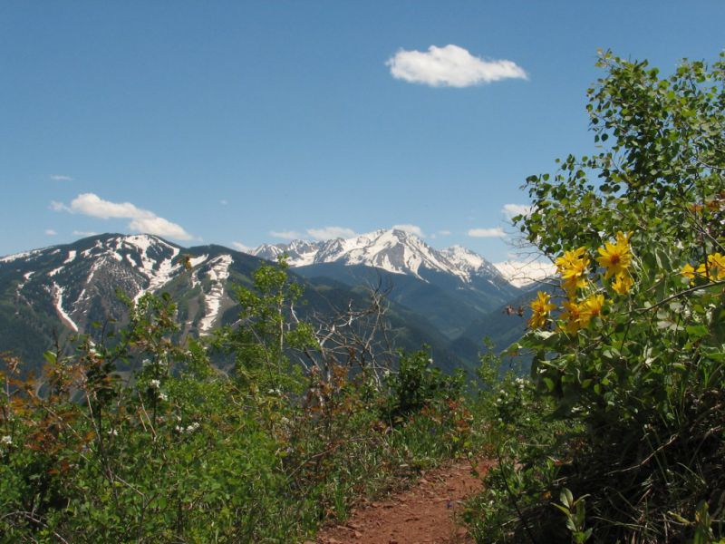
Views of the valley, Aspen Mountain, Aspen Highlands, Buttermilk, and the majestic Pyramid Peak, a classic 14er, will be your reward for making this excursion.
Along the journey, keep an eye out for marmots, and don’t forget your essential hiking equipment and fully charged camera!
How to Get to Aspen Snowmass
The Aspen-Pitkin County Airport is a tiny regional airport in Aspen with seasonal service to bigger neighboring cities.
The closest prominent international airport, Denver International Airport, is about three and a half hours from Aspen. Most US cities, as well as international cities, provide flights to Denver.
Although driving is the most convenient form of transportation, the Roaring Fork Transportation Authority (RFTA) provides paid services to Basalt, Glenwood Springs, and Rifle, as well as free bus service throughout Aspen and Snowmass Village.
If you’re coming from Denver, you’ll need to rent a car because, aside from a few mountain passes that are occasionally blocked for the season, State Highway 82 is the sole route into Aspen.
Since Aspen is a fairly bicycle-friendly city, getting around on two wheels is simple once in town.
Through a service called We-cycle, you can check out and check in rental bikes from one of twenty different spots. You can also rent a bike from one of the numerous nearby bike shops.
Where to Stay
The Aspen Snowmass area offers plenty of lodging and camping options, no matter your budget. I would keep in mind that Aspen is one of the more high-end areas of Colorado similar to Vail, so make sure to budget accordingly.
Stonebridge Inn (a Hyatt property) in Snowmass Village is an affordable option compared to most of what you will find in the area, or check out Viceroy Snowmass for a more extravagant stay.
In Aspen you have countless luxury accommodations, such as Hotel Jerome, the W Aspen or the St. Regis Aspen Resort. But don’t count out some more modest choices like the St. Moritz Lodge and Annabelle Inn.
If you would rather sleep under the stars, then check the availability at Difficult Campground south of Aspen or Silver Queen Campground southwest of town.
Wrapping It Up…
Whether you’re a beginner hiker or you’ve been hitting the trails for years, hiking in Aspen Colorado provides tons of opportunities to get outdoors.
A high concentration of aspen forests is unique to the area – as the name might suggest – so if trees are your thing, you’re in for a real treat.
But the scenery is not just relegated to forests – a high altitude makes for the chance to explore alpine lakes, serene ridges, and prestigious mountain peaks.

Many of the best Aspen hikes are just a few miles from downtown, which means you can easily accomplish your outdoor excursions and return to the city at the end of the day to indulge in its delectable culinary delights.
It is easy to see why this area has some of Colorado’s best hiking trails!
Check out our Google Web Story – 7 Out of This World Aspen Colorado Hiking Trails