Nestled among the breathtaking peaks of the Colorado Rockies, Frisco, Colorado, stands as a pristine gateway to the wonders of high-altitude adventure (9,097 feet to be exact), one of our most favorite mountain towns.
Its pristine alpine landscapes, crisp mountain air, and an abundance of hiking trails make it an outdoor enthusiast’s dream.
In this guide, we’ll take you on a journey through the heart of this charming town, revealing the best hikes near Frisco, CO.
Whether you’re a seasoned hiker seeking new challenges or a nature lover yearning to explore some of the most scenic vistas in the state, Frisco’s trails offer an unforgettable experience that will leave you in awe of the region’s unparalleled beauty.
So, get ready to embark on an unforgettable alpine adventure in Frisco, where every step (or incline) promises to take you closer to nature’s glory.
Best Hikes Near Frisco, CO
1. Rainbow Lake Trail
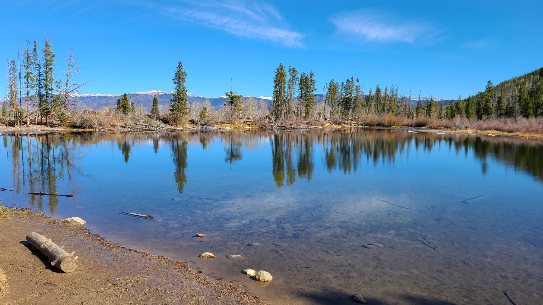
Only a half-mile walk from Frisco’s Main Street, Rainbow Lake Trail is a family-friendly hike with an abundance of wildlife and beautiful scenery. It is a 2-mile out-and-back excursion with only a slight elevation gain (about 150 feet).
Although a popular trail choice for locals and tourists, with the ample parking and its walkability from town, it never feels too overcrowded.
Rainbow Lake is quaint and a perfect location for a picnic or to just take in the peacefulness. Alongside the lake is a flowing stream, which adds to the relaxing atmosphere.
We turned around at Miners Creek Rd., but you can put in more miles and connect back up with Peaks Trail if you feel inclined.
You can read more about our hike to Rainbow Lake via Peaks Trail #45…
TIP: Once you are off the boardwalk section, the path is rocky and rooty, so watch your step.
Rainbow Lake
Difficulty: Easy
Distance: 2 miles (3.2 km)
Trail Type: Out-and-Back
Location: 39.56901, -106.0998
2. Mount Royal Trail
If you want to gain hiking experience and work on climbing agility for your first 14er, Mount Royal trail is a great place to do that. The hike is a challenging 4 miles out and back but offers incredible views of the town of Frisco, Colorado.
The trail begins on the Ten Mile Canyon trailhead, a flat paved path, before transitioning to a steep incline through a forest of aspen and pine trees, the perfect ingredients for a Colorado fall hike.
Once you reach the top of Mount Royal (10,499 feet), you’ll have a spectacular perspective of the surrounding mountains.
Despite being a relatively short hike, Mount Royal Trail presents a great hill workout due to its elevation gain of almost 1,400 feet.
TIP: Wear micro-spikes for traction in snowy conditions and hiking poles are ideal for dealing with loose gravel on your downhills.
Mount Royal
Difficulty: Hard
Distance: 3.9 miles (6.3 km)
Trail Type: Out-and-Back
Location: 39.57498, -106.111051
3. North Tenmile Creek Trail
Conveniently located off of i-70 and near downtown Frisco, North Tenmile Creek Trail is a 6.7-mile out-and-back hike that runs along a creek, providing excellent waterfall viewing opportunities near your turnaround point.
The trail starts with a decent incline that eventually levels out and meanders through a dense pine forest and the Eagles Nest Wilderness.
There are a handful of creek crossings to navigate, but nothing too challenging. Short offshoots are along the path if you want to get closer to the water.
Although you don’t get sweeping views of a mountain range on this hike, there are plenty of photo opportunities.
TIPS: Keep an eye out for wildlife, as there have been sightings of moose in the area.
North Tenmile #37
Difficulty: Moderate
Distance: 6.7 miles (10.8 km)
Trail Type: Out-and-Back
Location: 39.57582, -106.11365
4. Mayflower Gulch Trail
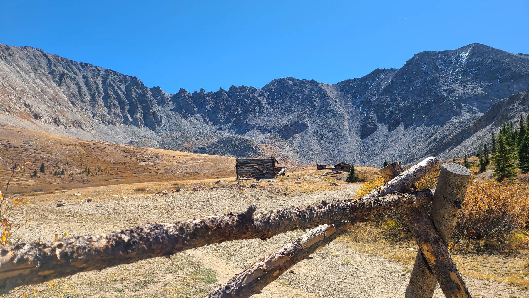
Mayflower Gulch Trail varies in distance depending on what you want to explore and see. A wide, 2-mile dirt path leads to the old Boston mines, where you can view the old structures. It is a gradual incline but isn’t very difficult (besides being 11,000 feet above sea level).
Once you arrive at the fork, you can head left to the mines or take a right and climb to a ridge with outstanding views.
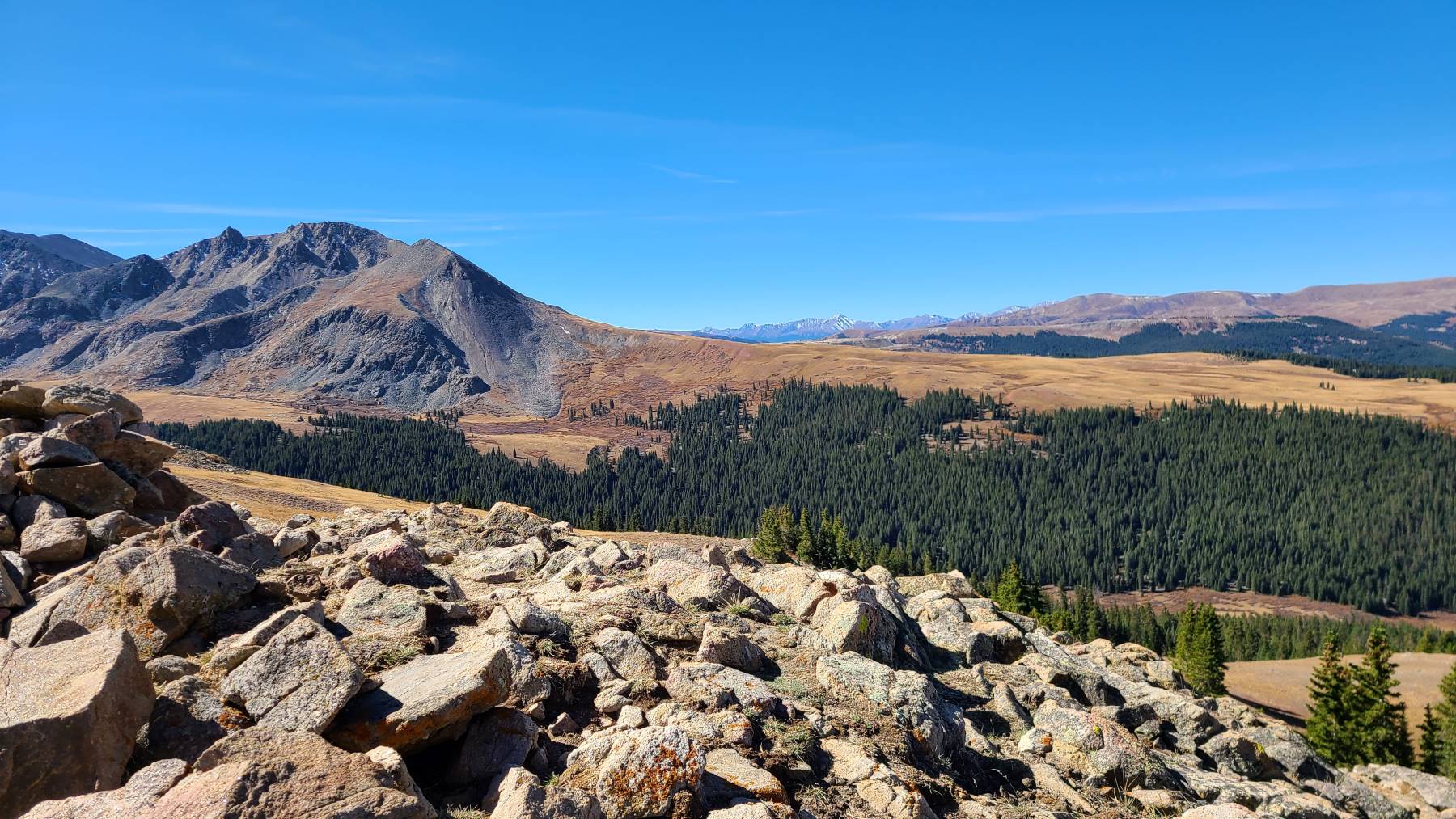
First, check out the mines, then return to the fork and take a right leading up a steep dirt path.
This accent is challenging, especially if you aren’t acclimated to the high elevation. You gain roughly 500 feet in three-quarters of a mile but will be rewarded with incredible 360-degree views.
Hiking the Mayflower Gulch trail can be done year-round, so expect beautiful golden colors in the fall, colorful wildflowers in the summer, and a snowy playground during winter snowshoeing.
TIP: Arriving early allows you to check out many of the old structures on your own before the crowds move in.
Mayflower Gulch
Difficulty: Moderate
Distance: 4 miles (6.3 km) – Boston Mines, 5.5 miles (8.9 km) – Boston Mines & Ridge
Trail Type: Out-and-Back
Location: 39.43071, -106.16562
5. Meadow Creek Trail
Ready to get those legs burning? Meadow Creek Trail offers almost 2,300 feet of elevation gain during your 8.4-mile out-and-back journey.
Like most mountain hikes, you’ll have stream crossings, amazing meadows, and stunning views of Red and Buffalo mountains.
The summer months offer wildflowers in full bloom and aspen trees will be a perfect shade of yellow during the fall.
From the Meadow Creek Trail, you can take an offshoot path to Lily Pad Lake. Or you can see what you are made of by hiking an extra 2 miles to get to and from Eccles Pass (plus an additional 600 feet of climbing), complete with valley views of alpine lakes.
TIP: During the summer, make sure to wear bug repellent.
Meadow Creek
Difficulty: Moderate to Hard
Distance: 8.4 miles (13.5 km)
Trail Type: Out-and-Back
Location: 39.58956, -106.10601
6. Summit County Clinton Reservoir Loop Trail
The Clinton Reservoir loop trail is a good option for those who want to ease into hikes since being over 10,000 feet in elevation is no simple task.
The trail is just over 2.5 miles long and circles the reservoir with two distinct terrains. The north side is muddy and rocky from water runoff and being closer to the water. The southern end is covered in pine needles, giving an almost springy feel with each step.
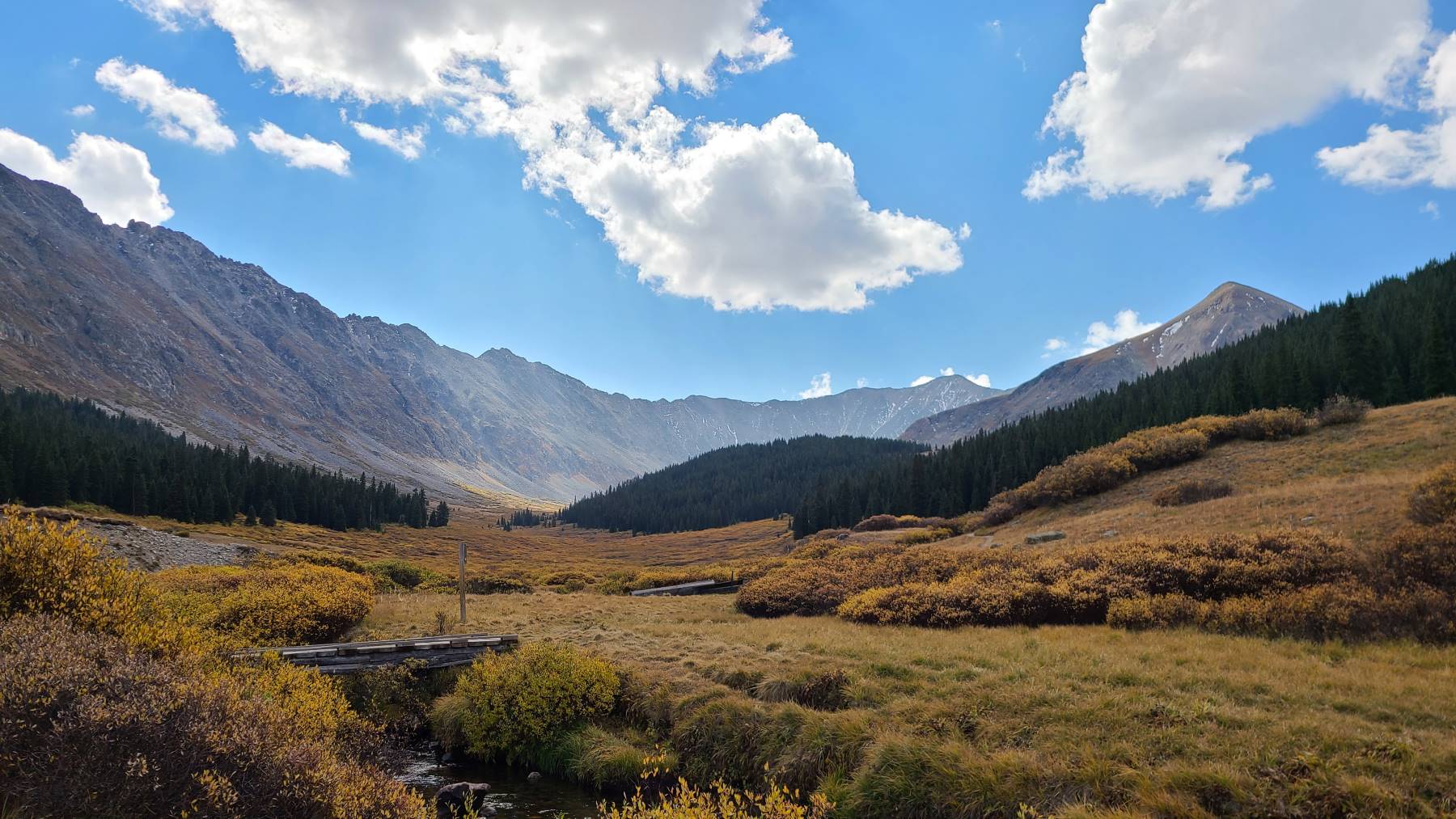
Halfway in, you are welcomed by Clinton Gulch, which gives you amazing views and plenty of photo opportunities of both the meadows and the reservoir. As you round the corner, you will climb gradually until you reach the south parking lot.
More spectacular views and even a peak of Fletcher Mountain are to be expected as you make your way through the dense pine trees.
Once you reach the south lot, a path links you back to your starting point. You will get one last mountain view here, but be careful, as you are right along the main highway.
Although stunning, the road noise does take away from the ambiance a bit, in my opinion.
TIP: Watch your step on the north side as the rocks get slick from mud. Some areas have thick vegetation, so watch for any low-hanging branches.
Clinton Reservoir Loop
Difficulty: Easy
Distance: 2.5 miles (4 km)
Trail Type: Loop
Location: 39.41559, -106.17135
7. Lily Pad Lake Trail
Lily Pad Lake Trailhead is located just outside Silverthorne, about an 18-minute drive from Frisco.
The trail is perfect for families looking to get out and explore what Colorado has to offer without too much elevation gain and a shorter roundtrip distance of 3.3 miles.
Although the hike begins with a decent incline on a service road, it is short-lived, so don’t fret! Once the climb is over, you’ll get a glimpse of Lake Dillion off in the distance and eventually walk past a beaver pond.
The real highlight of this hike is, of course, the lily ponds, and if you plan in right (around July-ish) you will even see them in full bloom, which is extra special. Bring a snack or lunch and enjoy a picnic near the pond and in the open space.
TIP: The lake is also reachable by the Meadow Creek Trailhead but is a more challenging trek.
Lily Pad Lake
Difficulty: Easy to Moderate
Distance: 3.3 miles (5.3 km)
Trail Type: Out-and-Back
Location: 39.61931, -106.11039
8. Peaks Trail
Peaks Trail is an excellent option for those hikers seeking a point-to-point exploration. At 8 miles in one direction, you can start in Frisco and make your way to Breckenridge Peak 7.
What makes this a good point-to-point hike is that Summit County has a free shuttle service that will take you back to your original location (make sure to research the shuttle stops – and the fact that you need to add extra mileage to get there).
Of course, you can hike back to your starting point, but be sure to allow enough time for a 16-mile roundtrip trek.
Along the way, you will travel past Rainbow Lake, aspen groves, bridges, streams and have panoramic views of the area.
TIP: Mountain bikers also use the Peaks trail, so be cautious with any uphills/downhills and corners.
Peaks Trail – Frisco to Breckenridge
Difficulty: Hard
Distance: 8 miles (12.9 km) or 16 miles (25.7 km)
Trail Type: Point-to-Point or Out-and-Back
Location: 39.56901, -106.0998
Wrapping It Up…
Frisco, CO, is a treasure trove of high-altitude hiking adventures, offering an unparalleled opportunity to connect with nature. From challenging peaks to serene alpine lakes, this town offers a diverse range of outdoor experiences that will leave you captivated.
And after a day of exploring, there’s no better way to celebrate your journey than by heading to Prosit for a well-deserved pint and to savor the sense of accomplishment that only Frisco can provide.
