The Shawnee National Forest is a nature lover’s paradise. Even though it had been some time since I first discovered these hidden gems back in my days at Southern Illinois University Carbondale, I was excited to once again explore some of the spectacular hikes in Shawnee National Forest.
From Pomona Natural Bridge to Garden of the Gods, it is home to some of the most breathtaking trails in the Midwest that display the area’s natural beauty.
I’m eager to share some of the best hikes in Shawnee National Forest with you!
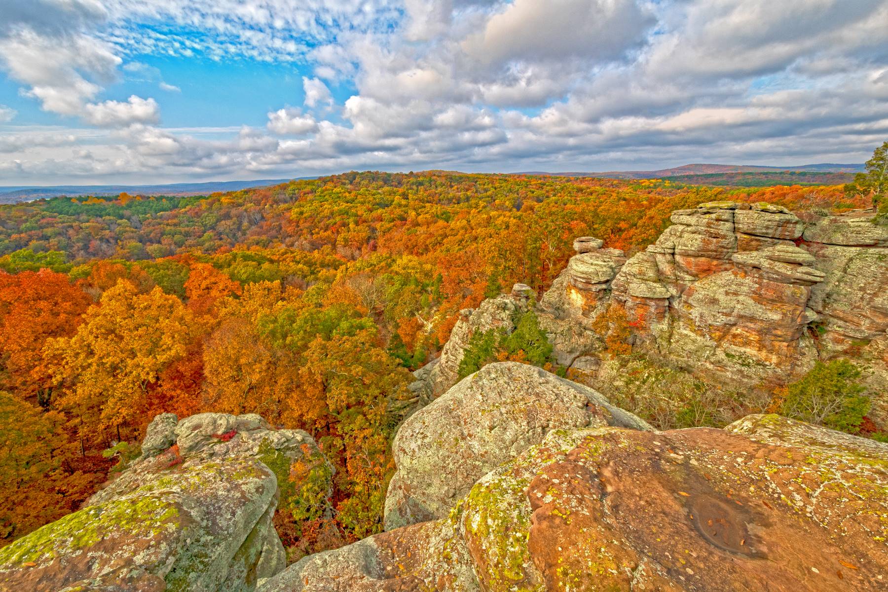
Overview of Hiking in Shawnee National Forest
You can explore stunning waterfalls, spectacular bluffs, and vibrant wildflowers on the trails of Shawnee National Forest!
With more elevation gains than you might expect in this part of the US, this area offers something for every skill level. Enjoy camping, take your pup on a leash, or just enjoy the natural beauty of the area.
To make the most of your hike, arrive early or on weekdays to avoid crowds and come prepared with bug spray, a plan for packing out your trash, and a commitment to leaving no trace.
Now it’s time to explore the best Shawnee National Forest hiking trails, so get your boots ready!
Easy Hikes in Shawnee National Forest
1. Ferne Clyffe Waterfall Trail
Distance: 1.3 miles (2.1 km)
Trail Type: Loop
Location: Goreville, IL (37.54292, -88.97972)
Ferne Clyffe Waterfall Trail in southern Illinois is a must-see trek, offering awesome rock formations and lush vegetation views.
Starting at Deer Ridge Campground, the 1.3-mile trail takes you up 206 ft. of elevation before arriving at the beautiful waterfall.
March through October is the best time to visit, allowing you to explore the area in its full glory. Unfortunately, markings are reportedly poor, so watch your step and bring a map!
With its stunning scenery, Ferne Clyffe is easily one of the best hiking trails in Shawnee National Forest.
2. Garden of the Gods Observation Trail
Distance: 0.5 mile (0.8 km)
Trail Type: Loop
Location: Karbers Ridge, IL (37.60463, -88.38437)
Situated in the rolling hills of Southern Illinois, the Garden of the Gods Observation Trail in the Garden of the Gods Recreation Area offers a unique opportunity to experience stunning views with just a short jaunt.
This 0.5-mile hike has an elevation gain of 52 feet and plenty of offshoots and lookouts to explore. It’s not wheelchair or stroller accessible, but still worth a visit for its breathtaking views.
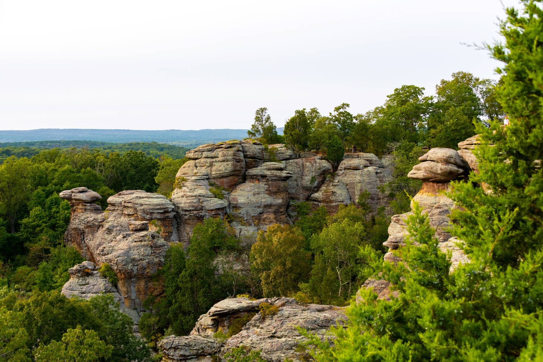
It can get crowded since you don’t need to walk too far for the views. Rock climbers will love the challenge the trail presents, and hikers will appreciate the opportunity for exploration.
Come see why the Garden of the Gods Observation Trail is a must-see destination!
3. Giant City Nature Trail
Distance: 1.2 miles (1.9 km)
Trail Type: Loop
Location: Near Makanda, IL (37.59561, -89.18881)
Located in Giant City State Park, the Giant City Nature Trail is an ideal spot for hikers to explore the park’s diverse landscape.
It’s a 1.2-mile loop with some steep inclines and gravel or flagstone steps, so you’ll get a good workout.
Be on the lookout for features like rock formations, including the Devil’s Standtable, and is great for wildlife viewing and photography. You’ll find native oak, hickory, dogwood, and maple trees and seasonal wildflowers.
Birders, hikers, and runners all use the trail, as it is part of a larger system in the park, and it’s well-maintained, so you won’t have to worry about getting lost.
The path is open year-round, so you can enjoy it anytime.
4. Cache River Natural Area
Distance: 7.4 miles (11.9 km)
Trail Type: Loop
Location: Heron Pond Reserve, Belknap, IL (37.3571, -88.91325)
The Cache River Natural Area boasts a beautiful 7.4-mile loop near Belknap, perfect for birding, hiking, and running.
The path is generally considered easy and takes an average of 2 hours and 27 minutes to complete. It’s open year-round and includes views of a swamp and a huge oak tree.
This trail is a must-do for those seeking a great outdoors experience. Unfortunately, no pooches are allowed, but the hike is still worth it.
With its natural beauty and easy access, the Cache River Natural Area is among the best Shawnee National Forest hikes.
5. Pomona Natural Bridge
Distance: 0.3 mile (0.5 km)
Trail Type: Loop
Location: Pomona, IL (37.64861, -89.34282)
Step away from the hustle and bustle of everyday life and explore the wonders of Pomona Natural Bridge.
Take the 0.3-mile loop and enjoy the 68 ft. gain in elevation, all in an average of 10 minutes.
Marvel at the forest views, water (can be dry if no recent rain), and wildflowers. It may be short, but it has some steep rocky sections. Beware of Poison Oak.
6. Bell Smith Springs Trail
Distance: 1.4 miles (2.3 km)
Trail Type: Loop
Location: Ozark, IL (37.51907, -88.65755)
Stroll along Bell Smith Springs Trail and experience the serenity of the surrounding nature with its stunning views of the bridge, bluffs, creek, and rock formations.
This 1.4-mile loop is home to a natural bridge, the largest of its kind in Illinois, spanning 150 feet long, 30 feet wide, and 60 feet high.
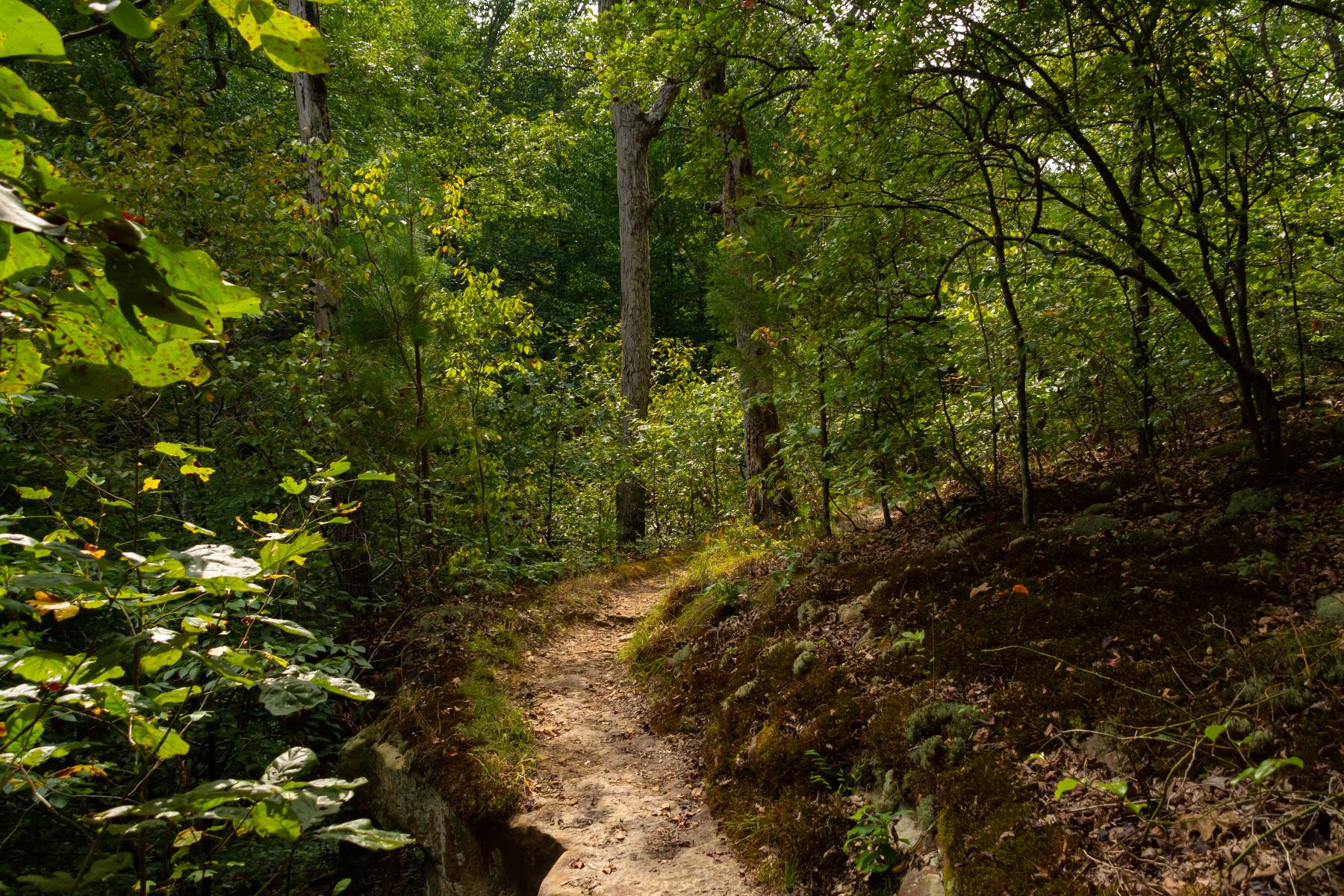
It’s a National Natural Landmark Trail System, home to 700 species of plants and lichens, representing 20% of the total known in the state.
You can enjoy birding, hiking, walking, and seeing wildflowers and other wildlife.
7. Stone Face Trail
Distance: 1.6 miles (2.6 km)
Trail Type: Out and Back
Location: Harrisburg, IL (37.66111, -88.43799)
Explore the rugged beauty of Old Stoneface Trail, a 1.6-mile out and back, and take in the stunning views of the bluff, rock formations, and scenic overlooks in just 44 minutes.
Climb up an ancient rock face resembling an old man’s or woman’s face, and enjoy the Natural Area with its threatened species.
At the top of Eagle Mountain, take in the spectacular view from the lookout. The lower portion of the trail features interesting bluff lines and rock formations.
Remember to watch out for snakes, poison ivy, ticks, and severe weather.
Don’t Miss:
Start planning ahead and check out these other great hiking areas:
Moderate Shawnee National Forest Hikes
8. Jackson Falls
Distance: 4.2 miles (6.8 km)
Trail Type: Loop
Location: Simpson, IL (37.51018, -88.68210)
Marvel in the awe-inspiring beauty of Jackson Falls, a 4.2-mile loop in the Shawnee National Forest of southern Illinois.
Leashed dogs are welcome to join in the adventure. The best times to visit are March through October.
Along the trail, you’ll encounter a ‘dog leg’ into the canyon and some rock climbing and bouldering opportunities. Just be prepared for the potholes and gravel road leading to the trailhead.
You’ll need to watch your step because the trail can be slippery and icy during certain seasons. Plus, it can be tricky to follow.
9. Burden Falls
Distance: 1.2 miles (6.8 km)
Trail Type: Out and Back
Location: Stonefort, IL (37.56353, -88.64238)
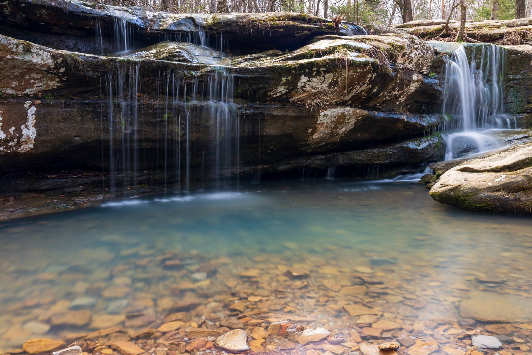
Discover the picturesque beauty of Burden Falls, a 1.2-mile out-and-back trail that offers stunning views of a waterfall and scenic vistas year-round.
This moderately challenging route is located in the Shawnee National Forest. Use caution after recent rain, as the rocks will be slick when wet.
Along the way, you may spot various wildlife and plant life, including wildflowers. Although it may be dry during some seasons, you can still enjoy the area’s beauty.
10. Rim Rock National Recreation Trail
Distance: 1.7 miles (2.7 km)
Trail Type: Loop
Location: Junction, IL (37.60237, -88.27821)
The Rim Rock Trail is a 1.7-mile loop with around 350 feet in elevation gain, located in the Shawnee National Forest.
This moderate trek is popular for hiking and running. It offers a stunning view of the surrounding forests.
It’s the perfect place to enjoy nature and escape the hustle and bustle of the city.
You will first walk around the rim before descending into the valley where large rock formations surround you. It’s no wonder why the Rim Rock Trail is one of the most popular hiking trails in Shawnee National Forest!
11. Rocky Bluff Trail
Distance: 2.2 miles (3.5 km)
Trail Type: Loop
Location: Makanda, IL (37.641999, -89.09772)
Experience breathtaking scenery as you meander through the Rocky Bluff Trail in Makanda, Illinois!
The trail is 2.2 miles long with mild inclines, making it perfect for a leisurely stroll.
With its looped path, you can take in scenic views of waterfalls and wildflowers and spot local wildlife.
Like most waterfalls in the Midwest, if there hasn’t been recent rain, the waterfalls will be dry.
A $2.00 daily use tag is required when entering Crab Orchard Wildlife Refuge.
One downside is the parking lot is limited to only a few vehicles, so head to the trail early to grab a spot.
12. Panther Den
Distance: 3.0 miles (4.8 km)
Trail Type: Loop
Location: Panther Den Wilderness, Makanda, IL (37.57985, -89.08812)
Take a journey through the Panther Den Loop for a unique exploration of stunning rock formations and creek crossings!
This 3-mile loop in Makanda offers an incredible outdoor experience.
The path can be muddy, so make sure to wear hiking shoes with good grip.
Marvel at the rock formations and bluffs, and during certain seasons, you can witness waterfalls. But stay alert for venomous snakes, poison ivy, and ticks. Bring a hiking stick to help clear the dense spider webs.
The trail can be challenging to follow at times, so it is worth having a GPS app to stay on track. Follow the safety precautions and have a fantastic adventure in the Shawnee National Forest.
13. Lusk Creek Trail
Distance: 12.9 miles (20.8 km)
Trail Type: Loop
Location: Eddyville, IL (37.53044, -88.5708)
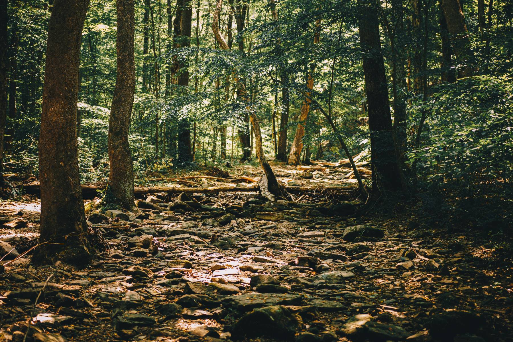
The Lusk Creek Trail spans 12.9 miles and takes about 5 hours to complete. The path is popular for horseback riding, so be on the lookout for horse manure as you hike through the forest!
Lusk Creek Loop is part of the River to River trail system in the Shawnee National Forest and offers a moderate challenge with amazing rewards.
With a considerable amount of elevation gain, you’ll be rewarded with stunning views and the possibility of wildlife sightings.
14. One Horse Gap Trail
Distance: 5.1 miles (8.2 km)
Trail Type: Out and Back
Location: Herod, IL (37.51564, -88.45304)
Embark on the 5.1-mile out-and-back One Horse Gap Trail near Herod, Illinois, for incredible views from the overlooks.
This trail is moderately challenging, with just over 550 feet in elevation gain and takes an average of two hours and two minutes to complete.
Popular for hiking and horseback riding, the best times to visit are from April to October. Keep in mind that the access road may require an off-road vehicle in some areas.
15. Mill Branch Trail
Distance: 1.9 miles (3.0 km)
Trail Type: Loop
Location: Ozark, IL (37.52340, -88.66077)
Clocking in at 1.9 miles and just over 100 feet of elevation, the Mill Branch Trail near Ozark, IL, is moderate and a great challenge for outdoor enthusiasts.
It takes an average of 40 minutes to complete and can be done year-round.
Enjoy stunning views of the forest, river, wildflowers, rocky areas, and a historic site. The path is well-marked, but some parts may be overgrown or require creek crossings, so come prepared.
This trail in the Bell Smith Springs Natural Landmark is the perfect way to soak in the beauty of the Shawnee National Forest.
Difficult Hikes in Shawnee National Forest
16. Little Grand Canyon
Distance: 3.4 miles (5.5 km)
Trail Type: Loop
Location: Pomona, IL (37.68067, -89.39486)
Wander through the majestic Little Grand Canyon Trail on a 3.4-mile loop in Shawnee National Forest, which is moderately challenging but worth the effort.
It has some technical aspects and slippery sections, so wear suitable footwear and take caution as you explore.
I recommend hiking when it’s drier for a more moderate experience. Climb down into the canyon through the creek bed and enjoy the shade of the forests.
Be aware of bears in the area and take care if you have bad knees or limited mobility. The trail takes about 2 hours to complete and is well-marked and open year-round.
17. River to River Trail
Distance: 151.8 miles (244 km)
Trail Type: Loop
Location: Pomona, IL (37.68067, -89.39486)
Take a challenging 151.8-mile journey through Shawnee National Forest and explore the River to River Trail.
This trail is full of adventure from Elizabethtown on the Ohio River to Devil’s Backbone on the Mississippi. During this long trek, see what the Midwest offers, with bluffs, plains, wetlands and forests.
Along the way, you’ll pass through Garden of the Gods Wilderness, Lusk Creek Wilderness, and the Jackson Falls climbing area, to mention a few.
The River to River Trail Society has a guidebook with campsite information and other resources to help plan your voyage.
Wrapping It Up…
I’ve been hiking in Shawnee National Forest for years, and it never fails to amaze me. Everywhere you look, you can find something remarkable to explore.
Whether it’s the Hickory Ridge Trail’s breathtaking overlooks or the awe-inspiring cliffs of the Little Grand Canyon, every step you take will leave you with a lasting memory.
Hiking in Shawnee National Forest is like a journey through a magical wonderland, where every corner holds a new surprise, especially when you visit Southern Illinois in fall!
It’s an experience that everyone should enjoy at least once in their lifetime.

